

High Winds in Denver Prompt Warnings About Dangerous Fire Risk
A utility company shut off power to more than 100,000 of its customers around Denver early Friday morning after the National Weather Service issued a dire warning that parts of Colorado, Wyoming and Nebraska faced a dangerously high risk of wildfires through the day.
The Weather Service said Friday’s weather conditions — a potent combination of wind gusts reaching 100 miles per hour and relative humidity levels in the teens — would create a “particularly dangerous situation,” increasing the odds for rapidly spreading wildfires as dangerous winds shoot down mountainsides.
Forecast risk of fire weather for Friday
Risk
Elevated
Critical
Extremely Critical
A “particularly dangerous situation” designation is a type of warning that the Weather Service uses only rarely when especially extreme conditions are forecast.
The warnings have traditionally been used primarily for tornado threats, but in recent years the Weather Service has begun using them for fires as well. One was issued in Los Angeles before devastating wildfires killed more than 30 people in January, and also for parts of the South in the spring before tornadoes left at least two dozen people dead.
Forecasters in Colorado said Friday’s warning was the first time they had issued one for fires in the state.
The fire risk on Friday was spread across a large portion of the Great Plains, but the greatest threat fell within an area of southeastern Wyoming, western Nebraska and northeastern Colorado, with the most extreme conditions between Cheyenne and Boulder. The most severe conditions were expected into the afternoon and evening.
By early afternoon, some small fires had been reported, and quickly extinguished.
“The wind is wild out here,” the Boulder Fire-Rescue Department wrote on social media, where it credited a quick response for helping to stop a fire “before a potentially serious spread.”
The Boulder County Sheriff’s Office shared a video of winds whipping across a deserted landscape that made Colorado look like the surface of Mars. “Please do not drive,” it said.
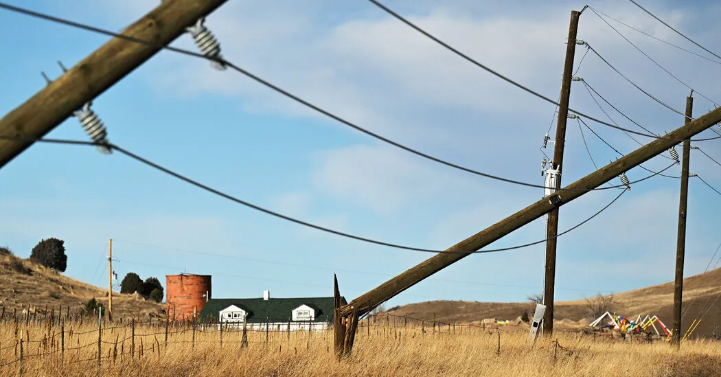
Warnings for high winds and fire risk have been present for much of this week across the region. Wind storms on Wednesday lashed Boulder, Fort Collins and other cities across metropolitan Denver, and in the foothills they snapped trees, toppled power poles and knocked out power to more than 100,000 people.
Power had still not been restored for many people by 8 a.m. Friday, when Xcel Energy imposed another round of blackouts that cut off power to more than 100,000 people across Colorado to reduce the risk that live power lines could start a wildfire.
Share of customers without power by county
The strong winds led the Federal Aviation Administration to issue a temporary ground stop at Denver International Airport on Friday morning, and delays threatened to snowball as the day went on. As of 10 a.m., more than 200 flights had been delayed, according to FlightAware, a flight-tracking service.
So far, there have not been any destructive wildfires in the hills. But several wind-driven wildfires late on Wednesday night burned at least 14,000 acres across Yuma County, a farming community on Colorado’s eastern plains.
The foothills of the Rocky Mountains and the Laramie Mountains should be a wintry paradise in mid-December. But a prolonged stretch of dry and unseasonably warm temperatures, combined with storms that have brought lashing wind but no snow, has turned much of Colorado and Wyoming into a Christmastime tinder box.
Colby Goatley, a meteorologist with the Weather Service office in Cheyenne, said the storms had brought snow to the north, to states such as Montana and the Dakotas, but little precipitation farther south to Colorado and Wyoming.
Moisture-starved vegetation, strong winds and dry air are the key ingredients that can lead to destructive wildfires. When a spark of fire enters the mix, it’s a recipe for disaster.
This happened in December 2021 during the deadly wind-whipped Marshall fire, which destroyed more than 1,000 homes and tore through the Denver suburbs of Louisville and Superior.
Patrick Marsh, with the Storm Prediction Center, said that weather similar to what occurred four years ago was unfolding on Friday.
“It doesn’t mean the Marshall fire is going to happen, but the conditions are there,” Mr. Marsh said.
The winds picked up overnight on the higher peaks of the mountains, and by early Friday, they were tumbling down to lower elevations.
“By midmorning to early afternoon is when places like Boulder, Colo., will see winds pick up,” Mr. Marsh said.
As the day progressed, the winds were expected to spread across the Colorado plains.
The blustery weather will dry out the air and push down humidity levels.
Forecasters with the Weather Service office in Denver said the most extreme conditions were expected to continue through midnight in the foothills of Boulder and Jefferson Counties. Gusts up to 100 miles per hour were possible from the Highway 93 corridor into the foothills.
Just after 7 a.m., Mr. Goatley said that winds in the Cheyenne region had picked up in the last hour.
“Moving ahead, we’ll expect the strongest winds now through the beginning of the afternoon,” he said, “but widespread strong winds will remain through the evening hours and then slowly lessen across the region overnight into Saturday morning.”